Syracuse experiences 3rd-rainiest October in city history
Will Fudge | Staff Photographer
Syracuse had 7.48 inches of rain in October, over three inches more than the city’s average.
Get the latest Syracuse news delivered right to your inbox.
Subscribe to our newsletter here.
On Tuesday, Oct. 26, Syracuse experienced its fifth-rainiest documented October day after receiving 2.33 inches of rain during the nor’easter.
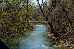
Syracuse had its third-rainiest October on record this year with 7.48 inches of rain. According to National Weather Service records, which began in 1902, the city traditionally receives just under four inches of precipitation in October.
Sam Tuttle, an assistant professor of earth and environmental science at Syracuse University, said a gradual increase in the average temperature of the earth caused the natural variations the climate system experiences. He speculated that this, in addition to climate change and jet stream location, contributed to the city’s warmer and wetter October.
Jet streams are relatively narrow bands of strong wind that form when warm air masses meet cold air masses in the atmosphere, Tuttle said. Scientists have observed less movement of jet streams, which often produces similar weather patterns for a specific period of time. The northeast is currently fixed in the warmer air that comes up from the southern hemisphere and is therefore experiencing a warmer and wetter climate.
“A lot of the wettest months we get are often related to a tropical storm or another big storm coming through and dropping a lot of rain,” Tuttle said. “The climate projections say that the tropical cyclones that we do have are going to be stronger because the ocean is warming, and warmer oceans are what fuels these big storms.”
Additionally, climate change cultivates a warmer atmosphere with a higher water-retention. This increases rainfall and snowmelt, which eventually results in intense flooding.
This summer’s inclement weather propelled Syracuse’s flooding this October. Central New York had its second-wettest summer on record this year, creating heavily saturated soil. Consequently, the soil’s pores were unable to absorb more water in October, yielding an accumulation of runoff. Tree dormancy also contributed to the flooding, as trees were no longer extracting and releasing water from the soil into the atmosphere.

Maya Goosmann | Digital Design Director
According to the city’s website, Syracuse is part of the National Flood Insurance Program Community Rating System. Every five years, Syracuse’s floodplain management activities are evaluated.
In 2019, Syracuse’s Community System Progress Report indicated that sufficient progress was made on 19 of the 22 floodplain management projects in place. Syracuse reassessed its measures to reduce the risk of flooding in 2019.
Many neighborhoods on the south and southwest side of Syracuse are at high risk of flooding because they lie adjacent to Onondaga Creek. To prevent runoff, the city put up a dam in 1949, and the city deepened and widened the creek bed when developing downtown areas.
Despite developments on various projects, Syracuse currently has eight adaptation measures to mitigate flood risk. These measures have proved to be adequate, as Syracuse is projected to have a moderate risk of flooding over the next thirty years.
The city continues to examine ways to further reduce its National Flood Insurance Program Community Rating. Syracuse intends to remove sediment from Onondaga Creek and find areas to store excess water, syracuse.com reported. The city seems to have sufficient infrastructure to prevent flooding as seasons continue to get wetter and more extreme. But Tuttle said it’s difficult to know what will happen.
“The atmosphere is chaotic, which means we have limited ability to predict it into the future,” he said.

Published on November 14, 2021 at 11:48 pm
Contact Anna: [email protected]